NOAA Extends Hurricane Forecasts from Three to Five Days;
Additional Planning Time Critical for U.S. Navy and Others
Reprinted with permission of accessNOAA
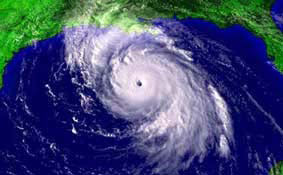 |
View of Hurricane Lili taken at 4:45 p.m. EDT on Oct. 2, 2002. |
The NOAA National Weather Service will begin issuing five-day hurricane forecasts this year, extending the three-day forecasts issued since 1964. NOAA is charged with protecting life and property against tropical cyclones by issuing timely and accurate hurricane forecasts, watches and warnings. The agency is extending the forecasts after a two-year test. The agency cited customer needs for longer-range forecasts and major improvements in track forecasting skill over the past few decades as reasons for lengthening the forecasts.
According to James R. Mahoney, Ph.D., Assistant Secretary of Commerce for Oceans and Atmosphere and NOAA Deputy Administrator, "This five-day forecast provides a valuable planning and preparedness tool, and is a tangible step forward in our efforts to protect lives and property and enhance the U.S. economy. The new forecast is particularly useful for those who need more than 72 hours advance notice to move resources out of harms way, such as U.S. Navy ships. Furthermore, as people and infrastructure crowd coastal areas, earlier awareness to a potential problem is needed to increase public safety."
Captain Jeff Bacon, Commander, Naval Atlantic Meteorology and Oceanography Center, Norfolk, Va., said, "U.S. Navy interest in the longer range forecasts are driven by the lengthy time required to protect major shore activities, move ships from port, or divert those at sea. Decision timelines often extend beyond four days in advance of the onset of destructive conditions."
Max Mayfield, NOAA's National Hurricane Center Director, said, "NHC and the Central Pacific Hurricane Center have been working closely with our customers since 1999 to extend the forecasts, and went through a rigorous set of experiments during the 2001 and 2002 Atlantic and eastern and central North Pacific hurricane seasons to test this capability. These experiments were successful largely because of improved modeling techniques developed jointly by the NOAA Geophysical Fluid Dynamics Laboratory, Environmental Modeling Center and other researchers." Data from the 2001 and 2002 seasons indicate the five-day track forecast will be as accurate as the three-day forecast was 15 years ago.
Accuracy in hurricane track forecasting is measured by "track error" -- the distance between the predicted position of a storm's center and its later, actual position. The two year trial showed the five-day average track error for Atlantic tropical storms and hurricanes was 323 nautical miles (nm), and 191 nm in the eastern Pacific. For comparison, in 1964-1965, the first two years of three-day Atlantic track forecasts, average error was 389 nm. Pacific errors are typically lower because many of the storms move generally east to west. While Atlantic storms often track east to west too, many curve toward the northwest and north and often accelerate, making them more difficult to forecast.
NOAA's National Weather Service is the primary source of weather data, forecasts and warnings for the United States and its territories. NOAA National Weather Service operates the most advanced weather and flood warning and forecast system in the world, helping to protect lives and property and enhance the national economy.
NOAA is dedicated to enhancing economic security and national safety through the prediction and research of weather and climate-related events and providing environmental stewardship of the nation's coastal and marine resources. NOAA is part of the U. S. Department of Commerce.
Relevant Web Sites for Hurricane Information
2002 Atlantic Hurricane Season Summary: http://www.nhc.noaa.gov/2002atlan_summary.shtml
NOAA National Hurricane Center -- Get the latest advisories here: http://www.nhc.noaa.gov/
NOAA Atlantic Hurricanes Database -- 150 Years of Atlantic Hurricanes: http://hurricane.csc.noaa.gov/hurricanes/
Saffir-Simpson Hurricane Scale: http://www.nhc.noaa.gov/aboutsshs.shtml
NOAA Satellite Images -- The latest satellite views: http://www.goes.noaa.gov/
Colorized Satellite Images: http://www.goes.noaa.gov/enhanced.html
NOAA 3-D Satellite Images: http://www.nnvl.noaa.gov/
NOAA Hurricanes Page: http://hurricanes.noaa.gov/
Media Contact: Frank Lepore, NOAA National Hurricane Center, (305) 229-4404
Page last modified: