Historical Nautical Charts Collection: New York Harbor
New York Bay and Harbor and the Environs
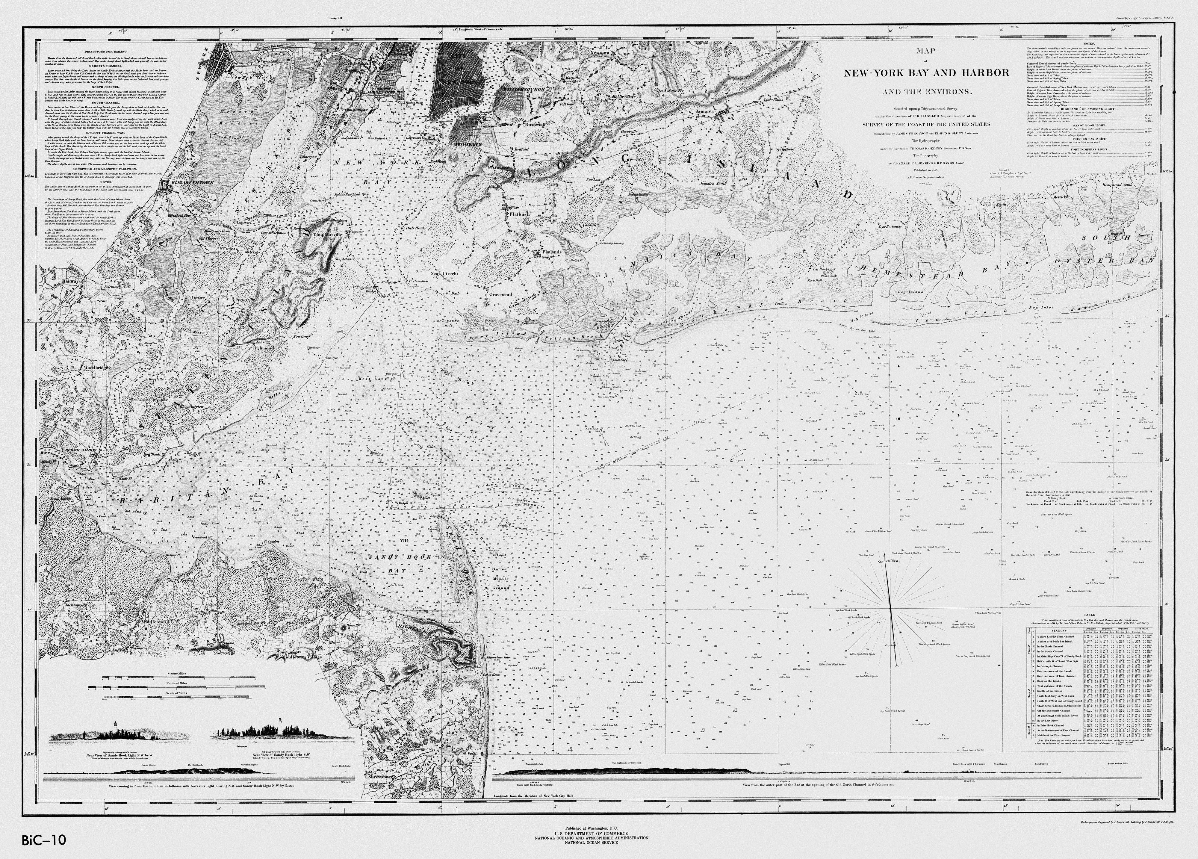
Figure 3. This black and white nautical chart, published in 1845, depicts a good pictorial image of
the early growth of New York City and its environs. The chart is likely one of the first nautical charts produced using
the copper plate printing press acquired by the U.S. Survey of the Coast in 1842.
(Click the image to enlarge.)
While this nautical chart, Figure 3, is not as detailed or "busy" as later charts in this collection, it does clearly depict water depths at low mean water level (but without the contour lines used in later charts). In addition, there is a table showing water levels during high and low tides for certain areas in the harbor, as well as information on the speed and direction of currents.
This chart includes a few interesting features, which are not included on more recent charts in this collection. In the upper left corner of the chart, you'll find directions for sailing through New York Harbor, including specific turns and landmarks to guide mariners to safe passage. The chart also includes a somewhat realistic cross section showing a vertical slice through the harbor. While cross sections appear on later charts, they are simple line drawings and lack the "artistic" rendering seen here.
Historical Reference
To make nautical charts, copper plates were engraved in reverse and then used in a press to produce a paper copy of the chart. In preparing plates for the press, the Survey of the Coast employed four engravers. The engravers worked on each plate in an assembly line fashion: one engraver might put on all lettering, another all numbers, another specific topographic features, etc., until the plate was completed. For this particular chart, two engravers completed the lettering and one engraved the hydrography.
Related Web Sites:
Office of Coast Survey: Historical Map and Chart Collection http://chartmaker.ncd.noaa.gov/csdl/ctp/abstract.htm
Works Consulted:
Theberge, A.E. (2001). Volume I of the history of the commissioned Corps of the National Oceanic and Atmospheric Administration: Part 1 - The Hassler legacy. Retrieved June 20, 2006, from: http://www.lib.noaa.gov/edocs/HASSLER5.htm.