PMO Corner: Ship Reports from the Straits of Florida in Plain Language
Weather and ocean observations taken at sea by the diligent crews of Voluntary Observing Ships (VOS) around the world are of great value to the weather forecasting enterprise. The VOS observations help to accurately initialize weather and ocean prediction models, and they are used directly by marine weather forecasters in their analyses of marine weather both along the coast and across the high seas. The VOS observations also are of interest to people in maritime communities along the coast, especially where few fixed or buoy observations are available. One such locale is the Florida Keys, an archipelago with island communities extending in a southwesterly arc from the southern end of the Florida Peninsula. The Florida Keys are located between the Gulf of Mexico and the Straits of Florida. Communities are connected via the “Overseas Highway”, a roadway consisting of 42 bridges. The Florida Reef tract, the third largest barrier reef in the world, lies just 5– 10 nautical miles south of the Keys, with the “Florida Current” typically flowing just beyond the reefs in the Straits of Florida between Cuba and the Keys.
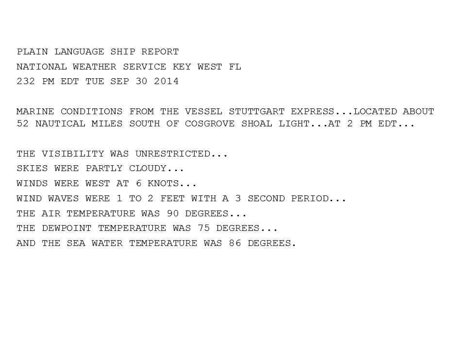
The shipping lanes in the Straits of Florida are among the busiest in the world, and the NOAA/National Weather Service Weather Forecast Office in Key West has developed a means by which to share VOS reports from the Straits with the local maritime community via a “Plain Language Ship Report”. Senior Forecaster, Sean Daida, and former Information Technology Officer, Tony Freeman, wrote a computer program that decodes VOS observations in the Straits, and presents a portion of each of the decoded reports in a plain-language bulletin. This Plain Language Ship Report then is shared both online and via broadcasts from NOAA All Hazards Weather Radio transmitters at Sugarloaf Key (VHF 2), Tea Table Key (VHF 5), and Princeton (VHF 4). (http://forecast.weather.gov/product.php?site =NWS&product=PLS&issuedby=KEY) Many people in the Florida Keys fishing, diving, boating, and cruising communities have found the VOS reports from the “big ships” offshore to be an important source of “sea truth”, and helpful to smaller craft heading out where no weather data buoys exist.

The VOS observations thus are valuable to a wide variety of users, including hurricane specialists, national and local marine weather forecasters, and even recreational boaters and charter boat captains in the Florida Keys.
Due to the great success of the Plain Language VOS Ship Reports that the Key West Weather Forecast Office has enjoyed, more weather offices along the Florida coast are quickly adopting this technology to their local web sites. Weather Forecast Office Miami will be adding this service to several points along the eastern coast of Florida to its Marine Weather Page in the very near future. As the popularity grows, we hope more coastal forecast offices in other states and regions look to the VOS ships and community for valuable weather data in the busy shipping lanes.
Back to top
